Volumetric Survey Services
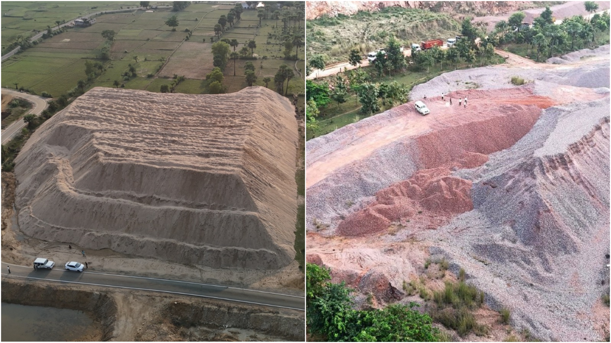
Our volumetric survey services provide precise measurement and calculation of material volumes for various industries including mining, construction, waste management, and agriculture. Using advanced technologies like drone photogrammetry, LiDAR, and DGPS, we deliver accurate stockpile measurements with millimeter-level precision, enabling better inventory management and operational planning.
Volumetric surveys are essential for tracking material quantities, monitoring site progress, and maintaining accurate records for compliance and financial reporting. Our methodology combines cutting-edge technology with expert analysis to provide reliable data you can trust for critical business decisions.
Our Volumetric Survey Solutions:
- Stockpile Measurement: Accurate calculation of coal, aggregates, ores, and other bulk materials
- Cut-and-Fill Analysis: Earthwork volume calculations for construction sites
- Landfill Capacity Monitoring: Waste volume tracking and remaining capacity assessment
- Quarry Management: Reserve estimation and extraction monitoring
- Agricultural Volume Analysis: Silage, compost, and biomass measurements
- Periodic Volume Comparison: Change detection between multiple surveys
- 3D Volume Modeling: Interactive digital models with measurement capabilities
Technology We Use:
- RTK-enabled drones for high-precision aerial surveys
- Terrestrial laser scanning (LiDAR) for complex structures
- DGPS for ground control points and verification
- Photogrammetry software for 3D reconstruction
- Advanced volumetric analysis tools
- GIS integration for spatial analysis
Our reports include detailed measurements, comparative analysis (when applicable), digital surface models, and professional documentation suitable for auditing purposes. We provide data in multiple formats including CAD drawings, GIS-compatible files, and customized reports tailored to your specific requirements.